Wednesday, January 22, 2014
Oceanography reflection
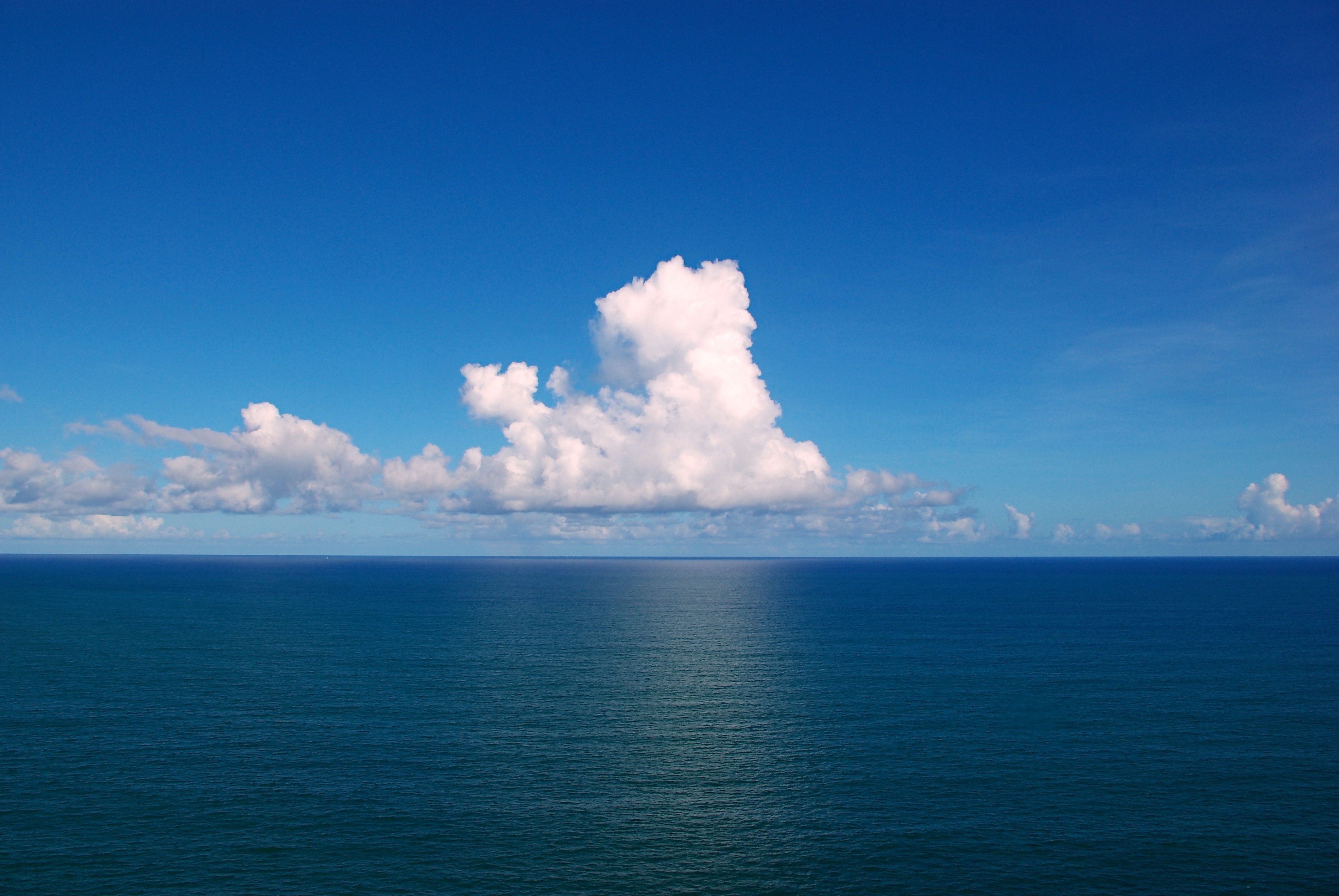
I learned a lot in the past few months in my oceanography class. There were a lot of hands on labs that were designed to help us understand the different properties of the ocean and the many forces that affect it. As a class, we watched a entertaining short documentary about real oceanographers who lived in an underwater research station. We also watched a discussion based video explaining how the ocean transmits sound and how whales use this to communicate. These videos brought up interesting topics of conversation because they addressed how humans have affected the ocean and the organisms in it. We also worked on various projects from creating a sea floor diagram to designing an island that would be both habitable by humans and the indigenous life. These projects were designed to help us learn the many geological terms that exist in oceanography. As a class we learned about the different types of coastline as well as what specific ocean features are called. Towards the end of the coarse we ended up learning about the density and salinity of water, and we had a few labs based on this topic. It was very interesting to see how these factors really makes the ocean a unique place to study. Overall I enjoyed the class and though it was a valuable use of my time. I think the biggest thing I took away from this class was I realized how important the ocean is to our everyday lives and the measures we as people need to do to protect it and all the life that it sustains.
Friday, January 17, 2014
What are the chemical properties of seawater?
Sander Casale
Oceanography
Oceanography
Station 1: An Introduction to Ocean Salinity
1.
Contrast
the differences between brine, marine, brackish, lake (aquatic), and local tap
water types based on salinity. Provide examples of where you find these water
types.
Marine, brackish, lake, and tap water all have a different salinity. usually Marine water is the most dense, then Brackish, then lake and then tap water.
2. The average ocean salinity is 3.5% but there are areas higher or lower than this value. Name three oceanic
locations that would differ from the average and explain what causes the
variation to occur.
3 oceanic locations that would differ from a regular ocean and its salinity would be in the arctic, the dead sea, and the Caribbean. The Caribbean's warm waters would make the sea water less dense, the opposite is true for the arctic ocean because of its cold waters making the water more dense. Lastly the dead sea is a strange exception form regular oceanic examples because its is higher in salinity, which is about 34%.
3 oceanic locations that would differ from a regular ocean and its salinity would be in the arctic, the dead sea, and the Caribbean. The Caribbean's warm waters would make the sea water less dense, the opposite is true for the arctic ocean because of its cold waters making the water more dense. Lastly the dead sea is a strange exception form regular oceanic examples because its is higher in salinity, which is about 34%.
3. Contrast the principles behind how a
hydrometer and how a refractometer measure salinity.
a hydrometer measures salinity using gravity in a slightly different way than a refractometer in the sense that the hydrometer does not use a dial to measure the salinity of water. Also, a refractometer is more reliable.
a hydrometer measures salinity using gravity in a slightly different way than a refractometer in the sense that the hydrometer does not use a dial to measure the salinity of water. Also, a refractometer is more reliable.
4. Explain how the temperature of the
water affects the salinity.
Generally saltier waters are located in more warm regions, and cold water is more dense while warm water is less dense.
Generally saltier waters are located in more warm regions, and cold water is more dense while warm water is less dense.
5. Which salinity-measuring tool would
be easier to use in the field?
a refractometer would be easier to use in the field because it is more stable and reliable.
a refractometer would be easier to use in the field because it is more stable and reliable.
Station 2: The Effects of Temperature, Density, and Salinity
1.
From
examination of your Station 2 plots, which seemed to have a greater effect on
the density of water, temperature or salinity? Explain.
Salinity appeared to have a greater effect in my salinity experiment. This is probably because the temperature of water can only reach a certain point until it is not water anymore, where as very polluted/salty water can have a much higher salinity.
Salinity appeared to have a greater effect in my salinity experiment. This is probably because the temperature of water can only reach a certain point until it is not water anymore, where as very polluted/salty water can have a much higher salinity.
2. From the third graph plot of Station
2 (T-S Diagram), can the salinity stay the same while the temperatures and
densities change? Explain.
The salinity cannot stay the same while the temperature an density changes because temperature affects the salinity of water.
The salinity cannot stay the same while the temperature an density changes because temperature affects the salinity of water.
Station 3: Water Mass Identification Using T-S Diagrams
1.
In
the CTD profile you plotted, the deepest water had the lowest salinity.
Explain how this is possible. Hint: Remember that more than salinity affects
water density.
Deeper water is generally colder than warm water and colder water is more dense, but surface pollutants as well as more salts make surface water denser.
Deeper water is generally colder than warm water and colder water is more dense, but surface pollutants as well as more salts make surface water denser.
2. Normally you find high salinities at
the surface of the water, especially in samples taken closer to the equator.
Explain.
Normally deserts are around 30 degrees longitude on the earth and in these places close to the equator is where the higher salinity is in the ocean.
Normally deserts are around 30 degrees longitude on the earth and in these places close to the equator is where the higher salinity is in the ocean.
3. Why would scientists be interested
in identifying specific water masses?
Scientists might be interested in identifying different water masses because these water masses might be present in specific places that they are interested in studying.
Scientists might be interested in identifying different water masses because these water masses might be present in specific places that they are interested in studying.
Station 4: Factors affecting Salinity
1.
Examine
the transect line and your plotted graph and explain what causes the salinity
changes from the equator to the Bering Sea in the Arctic Circle.
2. Research what other factors can
alter the salinities in the ocean from its average of 35‰.
The value and importance of this activity
a. What is the unique chemistry of
seawater, how is it measured, what is its consistency and what are its physical
characteristics?
Seawater is denser than regular water and it is very abundant in our world. Seawater has different densities and salinities, and is vital for oceanic life.
Seawater is denser than regular water and it is very abundant in our world. Seawater has different densities and salinities, and is vital for oceanic life.
b. Why would scientists be interested
in the inorganic chemistry of water?
It will help them be able to study sea life better by understanding the environment they live in.
It will help them be able to study sea life better by understanding the environment they live in.
Friday, January 10, 2014
Build a Hydrometer activity questions
1. Define the
term salinity.
Salinity is the total quantity or concentration of all dissolved inorganic solids.
2. If you add
salt to a water solution, will a hydrometer float higher or lower in the water?
Explain your choice.
It will float higher because the salt makes the hydrometer more buoyant because the water is denser.
3. What
effect does the addition of salt have on the properties of water?
The addition of salt make the water more dense.
4. Is it
easier to float in the ocean than in a swimming pool? Explain why or why not.
It is easier to float on the ocean rather than a pool because the water in the ocean is more dense because of its salinity.
5. Define the
term density.
Density is defined as a measure of quantity such as mass.
6. The salinity of seawater is also affected
by the temperature of a body of water. Explain how temperature causes
differences in the salinity of water.
Cold water is more dense where as the opposite is true about warm water. This means cool ocean water is denser because the molecules of the liquid are moving slower. Warmth in liquids causes the molecules to move faster.

Cold water is more dense where as the opposite is true about warm water. This means cool ocean water is denser because the molecules of the liquid are moving slower. Warmth in liquids causes the molecules to move faster.
Wednesday, December 11, 2013
global wind patterns
The Earth is unevenly heated because it spins on an axis, it rotates in an elliptical pattern around the sun, and it is a sphere. This means that when the sun's light hits the earth, more direct light is concentrated toward the equator and less concentrated at the poles. Also, since the earth is spinning, it generates wind movement and this movement draws cold air from the north and warm air from the equator which create cold and warm fronts that contribute to the uneven heating of the earth. Finally the elliptical movement of the earth around the sun creates seasons which tend to drastically change weather patterns and result in uneven heating around the Earth. I learned some if this information by doing a global wind pattern activity, this activity accurately shows that because of the Earth's rotation the winds move in a spherical pattern.
The Earths rotation affect the movement of air and water masses. Since the Earth moves from west to east, this in fact makes the wind and ocean currents do the same. In class we did an activity that describes this example well. We took a ball and spun it in the same direction as the earth, then we lightly used a dry erase marker to draw a straight line from the top to the bottom. When the ball stopped spinning we took not of the pattern. In class we also learned of the Coriolis effect, which is a natural phenomenon in which it deflects the wind movements. We also learned of Hadley cells which were defined to us as tropic atmospheric circulations. The final thing we learned that day was that most deserts are found 30 degrees north or south of the equator because this is where the doldrums are.
Prevailing global wind patterns are global winds that blow in a particular direction on the earths surface that cause weather patterns. In the past these winds have been used for trading along with doldrums, the horse latitudes, and the westerlies. In our class we studied this topic and learned about how these wind patterns and their direction help planes fly faster to different locations and save more fuel.

http://upload.wikimedia.org/wikipedia/commons/9/9c/Earth_Global_Circulation_-_en.svg
Global warming might change wind/weather patterns because because of the rising temperature storms of all kinds might become more intense with stronger forces. The National Wildlife Federation has an article that explains this idea further providing more details.
http://www.nwf.org/Wildlife/Threats-to-Wildlife/Global-Warming/Global-Warming-is-Causing-Extreme-Weather.aspx
The Earths rotation affect the movement of air and water masses. Since the Earth moves from west to east, this in fact makes the wind and ocean currents do the same. In class we did an activity that describes this example well. We took a ball and spun it in the same direction as the earth, then we lightly used a dry erase marker to draw a straight line from the top to the bottom. When the ball stopped spinning we took not of the pattern. In class we also learned of the Coriolis effect, which is a natural phenomenon in which it deflects the wind movements. We also learned of Hadley cells which were defined to us as tropic atmospheric circulations. The final thing we learned that day was that most deserts are found 30 degrees north or south of the equator because this is where the doldrums are.
Prevailing global wind patterns are global winds that blow in a particular direction on the earths surface that cause weather patterns. In the past these winds have been used for trading along with doldrums, the horse latitudes, and the westerlies. In our class we studied this topic and learned about how these wind patterns and their direction help planes fly faster to different locations and save more fuel.
Global warming might change wind/weather patterns because because of the rising temperature storms of all kinds might become more intense with stronger forces. The National Wildlife Federation has an article that explains this idea further providing more details.
http://www.nwf.org/Wildlife/Threats-to-Wildlife/Global-Warming/Global-Warming-is-Causing-Extreme-Weather.aspx
Friday, November 22, 2013
Loggerhead Island Report
Report on your Loggerhead Island development proposal by answering the below questions. Include a photo of your plan in your report.
1. What special considerations did you have to make for the nesting sea turtle sites located on the barrier island?
Our plan to create a safe environment for the sea turtle nesting sight was to keep the hustle and bustle of the populated areas away from the sight. To do this we put the golf coarse semi near the sight and we put a barrier of indigenous trees blocking the coarse from the habitat.
2. What special considerations had to be made when determining a good site for the proposed fishing pier?
A special consideration that was made when determining the site for the fishing pier was to put it near the mangrove and sea grass areas to ensure the best fishing, but also the protection of these fragile habitats.
3. What could be some of the potential problems that might arise from the proposed golf course? Propose some of the ways in which the impacts can be reduced.
A problem might be the chemicals used to maintain the coarse, but in this case, the golf coarse is maintained using environmentally friendly substances, and the coarse was constructed with indigenous grass.
4. What are the economic benefits to the community of Loggerhead County if the development was done with the least amount of environmental impact?
The economic benefit to the community would be the appeal of a wealthy selective community with the natural beauty of the island that was ensured by the least amount of development.
5. Describe three ways in which humans negatively impact coastal ecosystems such as the one you are working on with Loggerhead Barrier Island.
Humans negatively impact coastal ecosystems by polluting, developing, and over fishing/hunting in these fragile environments. These ecosystems include plant and animal habitats.
6. How can maintaining natural vegetation help us to reduce the damage caused by oceanic events such as hurricanes, tsunami and continued beach erosion?
Natural vegetation like mangroves can help reduce the impact of natural disasters because they keep the soil intact by their spiderweb-like root system, and help buffer the impact of the waves slamming against the shore.
7. After listening to the other groups make their presentations, were there any ideas they had you would have used if you had though about it before-hand? You should list at least three different ideas and indicate why their idea is actually better for the environment than yours.
Other ideas that i would have thought of before hand would be remembering to use light restrictions on the houses, making some of the facilities closer to the road, and nature trails. these ideas help the residents of the island observe nature at a better vantage point by use of the trails, makes it safer by making the buildings closer to the road, and light restrictions ensure the animals won't be drawn to human activity.
Wednesday, November 20, 2013
A beach by any other name
Analysis of Results:
Interpret and analyze your results for each station by answering the following questions in your science journal.
Activity 1: A Beach by Any Other Name
1. Contrast the differences between a primary and a secondary coastline.
A primary coast line is a coast line created by erosion and other geological processes where as a secondary coastline is formed by organic means.
2. Provide three examples of the processes involved in both primary and secondary coastline classifications.
Erosion, volcanic activity, and glaciers form primary coasts. Secondary coasts are formed by waves, marine life, and the lowering of the sea level.
3. Contrast the east and west coasts of the United States based on the primary forces that are responsible for shaping their coastlines.
The west coast's coasts are mostly glacial and volcanic. The east coast's coasts are erosion based with some secondary coasts to the south. There is also glacial coasts up towards the north.
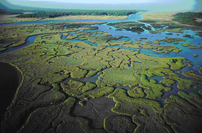
Activity 2: It's All in the Mix, A Study of Estuary Classification Based on Water Circulation.
1. Based on your data, the profiles you graphed, and the information provided in your text, provide an explanation for the three distinct estuary circulations.
The first distinct estuary circulation is a salt wedge and this occurs when high-salinity seawater slips into the estuary under the less dense fresh water from a river. The second distinct estuary circulation is a vertically mixed estuary where there is no distinct water layer. The third distinct estuary circulation are the between ones where the water partly mixes but there are still layers.
2. What are factors that could influence the circulation of water within an estuary?
Factors like temperature and pressure can influence water circulation in an estuary.
3. If you are fishing in an estuary that is well stratified is it possible to catch both freshwater and marine fish in the same general spot? Explain.
Yes, depending on the depth on which you are fishing.
4. Provide two examples of adaptations that estuary life had to make during their evolution that are different from open water marine species adaptations.
And adaptation made is that estuary's are where marine life go to be nursed and grow up until the organisms grow up and move out. Estuary's are like nurseries in the sense that they also provide protection from the elements, which is something open ocean marine organisms don't have.
Activity 3: Judging a Book by its Cover
1. Describe the economic services that are provided by estuaries.
Estuary's are like nurseries.
2. Describe the ecological services that are provided by estuaries.
Estuary's are nurseries that provide protection from the elements and other organisms.
3. No matter which estuaries are being discussed, they seem to be plagued by variations of the same
three different categories of human impacts. What are these impacts?
Pollution, development, and hunting/ fishing out the population.
4. Provide two examples of pollution problems that seem to be common in estuaries.
Trash and sewage are two examples of pollution problems that seem to be common in estuaries.
5. Provide two examples of development problems that seem to be common in estuaries.
Destruction of the fragile environment, and the development of structures on the habitats.

Activity 1: A Beach by Any Other Name
1. Contrast the differences between a primary and a secondary coastline.
A primary coast line is a coast line created by erosion and other geological processes where as a secondary coastline is formed by organic means.
2. Provide three examples of the processes involved in both primary and secondary coastline classifications.
Erosion, volcanic activity, and glaciers form primary coasts. Secondary coasts are formed by waves, marine life, and the lowering of the sea level.
3. Contrast the east and west coasts of the United States based on the primary forces that are responsible for shaping their coastlines.
The west coast's coasts are mostly glacial and volcanic. The east coast's coasts are erosion based with some secondary coasts to the south. There is also glacial coasts up towards the north.
Activity 2: It's All in the Mix, A Study of Estuary Classification Based on Water Circulation.
1. Based on your data, the profiles you graphed, and the information provided in your text, provide an explanation for the three distinct estuary circulations.
The first distinct estuary circulation is a salt wedge and this occurs when high-salinity seawater slips into the estuary under the less dense fresh water from a river. The second distinct estuary circulation is a vertically mixed estuary where there is no distinct water layer. The third distinct estuary circulation are the between ones where the water partly mixes but there are still layers.
2. What are factors that could influence the circulation of water within an estuary?
Factors like temperature and pressure can influence water circulation in an estuary.
3. If you are fishing in an estuary that is well stratified is it possible to catch both freshwater and marine fish in the same general spot? Explain.
Yes, depending on the depth on which you are fishing.
4. Provide two examples of adaptations that estuary life had to make during their evolution that are different from open water marine species adaptations.
And adaptation made is that estuary's are where marine life go to be nursed and grow up until the organisms grow up and move out. Estuary's are like nurseries in the sense that they also provide protection from the elements, which is something open ocean marine organisms don't have.
Activity 3: Judging a Book by its Cover
1. Describe the economic services that are provided by estuaries.
Estuary's are like nurseries.
2. Describe the ecological services that are provided by estuaries.
Estuary's are nurseries that provide protection from the elements and other organisms.
3. No matter which estuaries are being discussed, they seem to be plagued by variations of the same
three different categories of human impacts. What are these impacts?
Pollution, development, and hunting/ fishing out the population.
4. Provide two examples of pollution problems that seem to be common in estuaries.
Trash and sewage are two examples of pollution problems that seem to be common in estuaries.
5. Provide two examples of development problems that seem to be common in estuaries.
Destruction of the fragile environment, and the development of structures on the habitats.
Monday, November 11, 2013
A grain of history
"You are to describe and discuss the eight sands you examined this week. Start with the table of data you assembled on the eight (8) sands you looked at, and continue by making an interpretation of the environment of two of the sands, how far each traveled, and their ultimate source areas. Use the below clues to help you."
The Plum Island sand I observed was orange, had magnetite, was not fine in size, was moderately sorted, angular, and contained a variety of minerals such as quartz and garnet. The Key West sand sample I observed was white/ transparent in color, did not have magnetite, was not fine in size, angular, was well sorted and contained a variety of minerals and shells from ocean organisms. The Hampton Beach sand I observed was orange, black and white in color, did not have magnetite, was not fine in size, was roughly sorted, angular, and contained a variety of minerals including quartz and rocks such as granite. The St Martin's sand I observed was black and white, did not have magnetite, was not fine in size, angular, was poorly sorted and contained minerals and shells from organisms. The Praiade sand I observed was orange and transparent in color, had no magnetite, was fairly large in size, was well sorted, sub-angular, and contained a crystal minerals. The Maui sand I observed was orange, transparent, and black, had magnetite, was not fine in size, was poorly sorted, round-angular, and contained a variety of minerals and organic sediment as well. Desert Island sand I observed was orange/white, had magnetite, was big in size, angular,was well sorted and contained a variety of minerals and organic sediment. The Bonaire sand I observed was white, had no magnetite, was big in size, sub-angular, was well sorted and contained crystals.

Subscribe to:
Posts (Atom)